I have often reported here of places that are far south from arctic, but are remote enough to deserve a discovery by Thule sailors. That's the case of Achill Island, in the extreme west of Ireland, separated from the mainland island by a narrow channel. Landscape, imposing cliffs and sandy bays are Achill's main features.
Achill Island is the largest island off the coast of Ireland, more precisely the west coast. Its area is 148 km2, in a quite irregular shape.

The main villages are Keel (Keel an Caol), Dooega (Dumha Éige) and Dugort.

Achill is attached to the mainland by a bridge since 1887, between the villages of Achill Sound and Polranny; the current bridge was completed in 2008.


Coordinates: 53° 58′ N, 10° 02′W
Population: ~ 3 000
Achill Island (Gaelic name Oilean Acaill) has a long history of human settlement, with megalithic tombs and promontory forts dating back 5000 years. From the 15th century, a fortified tower house - Kildamhnait Castle; from the 19th century the deserted village at Slievemore.
Dugort
On the north side of Achill Island, Dugort is prized with two Blue Flag beaches: one at the foot of Slievemore mountain, the other more eastern Golden Strand, with sandy dunes and grasses.


The Valley House

The Valley House sits on the former estate of the Earl of Cavan, who built it as a hunting lodge. Presently it is serving as a hostel with tearoom and bar.

A Hotel is also installed on the former Achill Mission, established here in 1839.

The legacy of The Colony also includes St. Thomas's church:


Slievemore, deserted village

Some 80 ruined stone cottages strech along a mile long on the southern slopes of Slievemore hill, either side of an ancient pathway, almost all aligned in the same north-south direction.

They date at least to the Anglo-Norman period (12th Century AD). The cottages were used as uphill summer dwellings by cattle herder families from downhill villages like Dooagh. After the 1845 famine, the village was abandoned because the only food available was caught from the sea.

The area is rich in archaeological artefacts, including megalithic tombs dating from the Neolithic period, about the 3rd or 4th Century BC.
Keem Bay and the cliffs of Achill Head.

Located at the western tip of Achill Island - and therefore one of the most westerly points in Europe - Keem Bay offers a breathtaking clifftop road, over a perfect horseshoe bay, with a sandy beach flanked by dramatic cliffs and at the head of a spectacular valley.

The Blue Flag beach at Keem is perfect with its crystal clear waters revealing a variety of fish and sealife.

The cliffs on the western side of the valley provide on of the most exhilarating clifftop walks in Ireland, stretching back to Achill Head.

On the eastern side, the slopes rise up to meet Croaghaun peak, up to 668 m, with Europe's second highest sea cliffs on its northern face.


Keel

Keel (Keel an Caol) is probably the prettiest village in Achill, where several gabled two-storey houses remain from past centuries.


One of the few traditional houses remaining in the island.


Bervie guesthouse, splendid accomodation.

At Bervie, the hard boiled eggs come with a sweater !

Behive café, coffee shop and local crafts

Irish coffee and scone

Calvey's restaurant entrance.
You can also find in Keel one of the best galleries in the island - Western Light Art Gallery.

Dooega and the Atlantic Drive.

A little fishing village and beach on the southwest seashore, where the fabulous Atlantic Drive starts weaving along the coast.

The Atlantic Drive runs to the island's southeast by the Atlantic coast, winding along cliff highs and bay lows.


The Castle Tower at Kildavnet
The road then turns North and leaves the Atlantic behind; the most famous ex-libris of Achill follows after just a few miles. It is a fine example of a 15th Century Irish tower house.

Kildavnet (Cill Damhnait, Kildamhnait) is located on the south-eastern shore of Achill Island, overlooking the waters of Achill Sound.

Known as Grace O'Malley's Castle, it's associated with the O'Malley Clan, a ruling family of Achill.

Built about 1429, the Tower stands at a strategically important spot, guarding the waters of Achill Sound.

Parts of the present remains are thought to date from the 12th Century. Adjacent to the chapel is the ancient graveyard of Kildavnet, which contains many unmarked graves of 1845 famine victims.
Nearby, a small harbour for tourist boat journeys.

It is colourful.

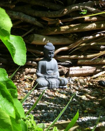
And the surprise: Achill Secret Garden.

Hidden in a small bay on the island's east coast, you find the most secret public garden in Ireland, belonging to Bleanáskill Lodge, a peaceful oasis two miles south from Achill Sound. The garden is situated by the sea.

It is difficult growing anything in coastal gardens with the winds and the salty air, but through the past decades most owners of the lodge contributed in one way or another to the garden.
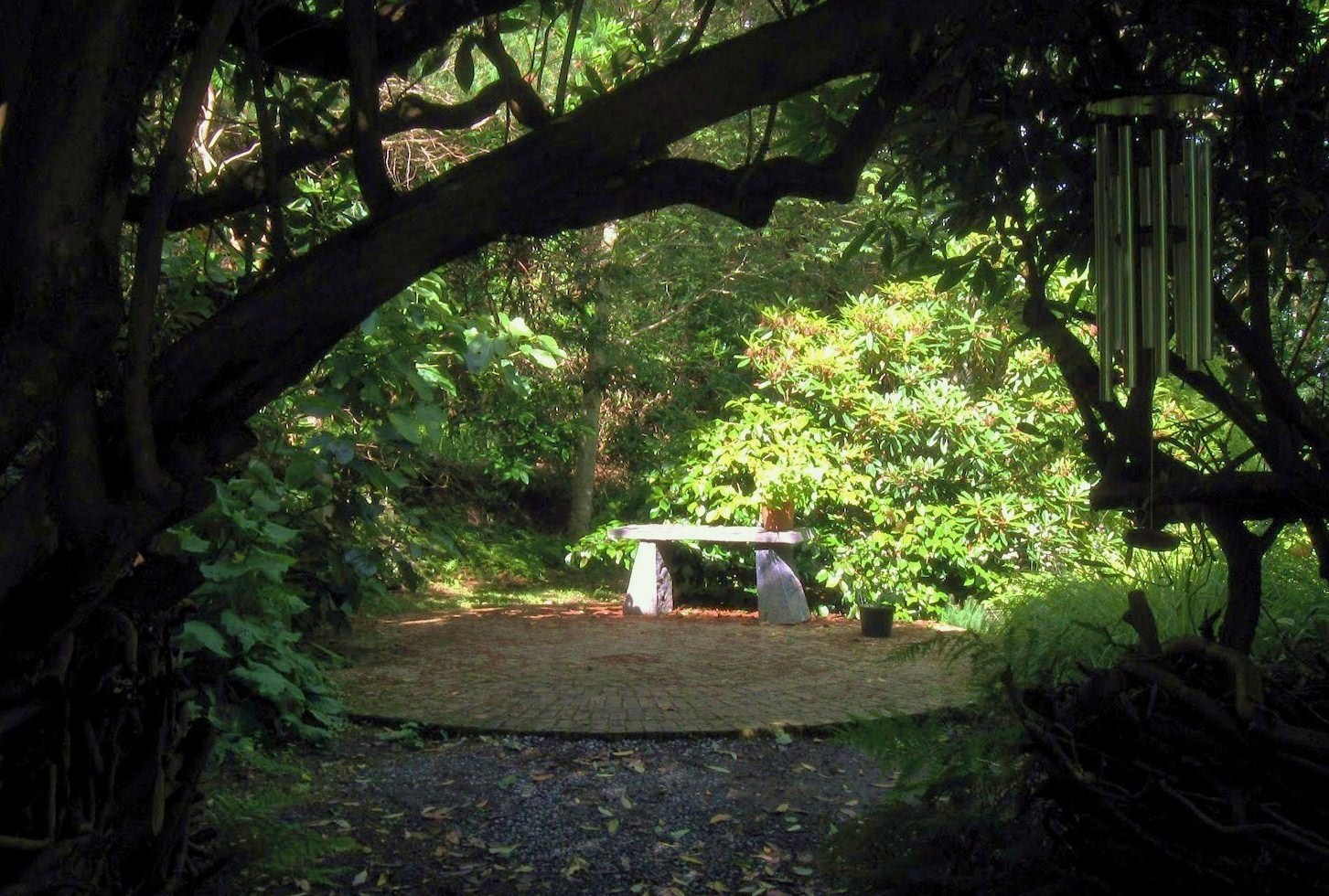

The garden is a paradise of colour, scents and sculpture.